Whitely Neighborhood

Whitely Header

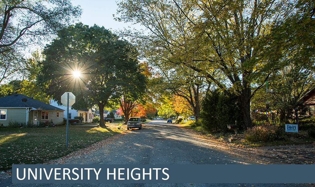
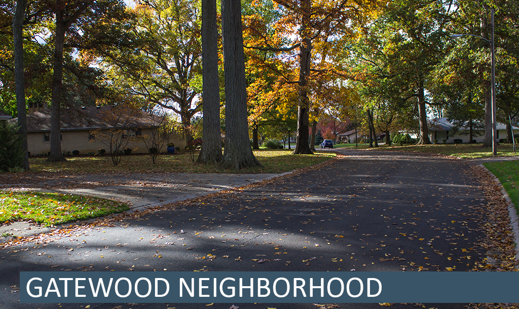
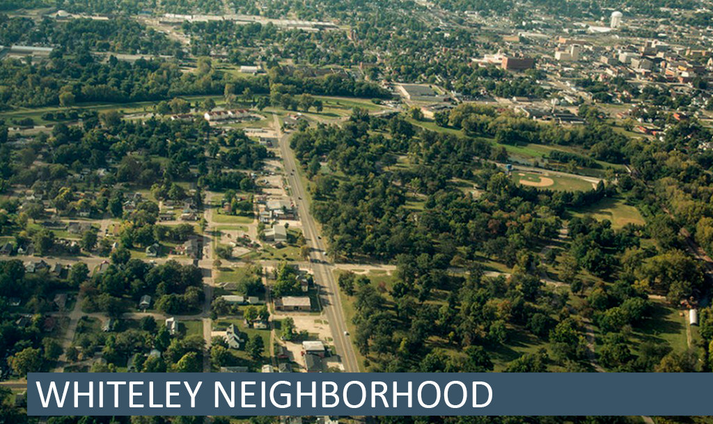
Whitely is “An Education First Community.”

The neighborhood goals are:

  1. Beautification
  2. Safety and Security
  3. Education and Health
  4. Employment and Entrepreneurs
  5. Pride and Events
  6. Resource Development
  7. Marketing and Public Relations
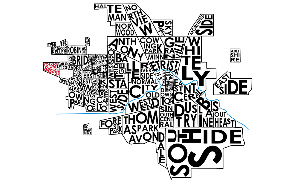
History

Whitely Town, Indiana was founded as its own city in the early 1890s by a wealthy man from Ohio named William Needham Whitely, who was known at the time as a great inventor and “the Reaper King.”  He envisioned that this place would become one of the major centers of industry in Indiana.  He chose this location during the “gas boom era” during which there were plentiful and cheap natural gas fields in east central Indiana.  Drilling for wells in Delaware County was fast and furious, but there wasn’t enough infrastructure to support the numbers of incoming workers from Ohio, Kentucky, and New York.

William, along with his brothers Burt and Amos ultimately chose Muncie on the advice of new Muncie resident and friend from Ohio, George F. McCulloch.  McCulloch, for whom “Woods Park” was renamed, helped orchestrate a great business offer and the Whitelys bought 1200 acres of the Wysor tract that was newly available and started to build Whitely Town.  The centerpiece was the William N. Whitely Harvesting Machine Company, which was built on the grounds that are now home to East Central Recycling.  Soon, a new railroad was built across the White River.  Later came the Whitely Inn, White Stables, Whitely Steel Co, Whitely Gas Co, Whitely Bakery, Whitely Public School (what is now Shaffer Chapel), Whitely Iron and Casting Co, Whitely Malleable Castings, Whitely Land Co, Whitely Tin Shop, and more. (source)

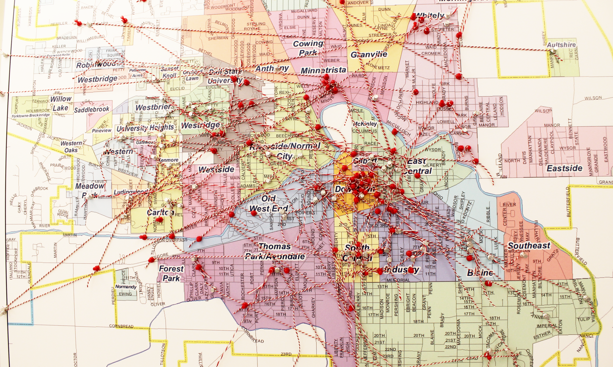
BSU Immersive Learning – Historical Maps

Neighborhood Association Meetings

The Whitely Neighborhood Association meets at 5:30 pm on the second Monday of every month at the Union Missionary Baptist Church. All are welcome.

On the Web

Webpage – http://whitelycc.org/

Facebook – https://www.facebook.com/whitelycc

Twitter – @WhitelyCC

Email – whitelycc@gmail.com

Neighborhood Action Plan

In fall 2011, Students from the Ball State University College of Architecture and Planning, under the direction of BSU faculty member Lisa Dunaway, worked alongside the Whitely Community Council to develop the Whitely Neighborhood Action Plan (WNAP). Since 2011, the WNAP has guided the neighborhood towards successful implementation of many of the identified action steps.

Neighborhood Maps

Whitely Map (pdf)

Whitely Neighborhood Areas (pdf)

Whitely self guided tour (pdf)

Join the private social network for your neighborhood at Nextdoor.

University Heights Neighborhood

History

Like many other neighborhoods across the country, University Heights began when the demand for housing increased greatly at the end of the Second World War. What had been farmland west of Muncie became the site of new homes in the late 1940’s and early 1950’s, as the postwar baby boom began in real earnest and returning veterans and others sought homes for their new and growing families. The response to the growth of University Heights and other similar neighborhoods included the opening of West View Elementary School in 1953 and Storer Junior High (later a middle school and now an elementary school) in 1960. The neighborhood went through a cycle of change as those young families grew and then moved off into their own neighborhoods. For some years the neighborhood has had a number of retired persons, but in recent years more young families have entered the area, starting the cycle all over again.

Neighborhood Association Meetings

A steering committee began meeting fall 2014 with their first meeting on, Thursday, April 9th of that year.

2016 Neighborhood Association meetings will be held on March 10, June 9, September 8, and December 8 at the Riverside Baptist Church, 3700 W. Riverside, from 6:30-7:30 PM. All are welcome!

2015 April 9th Meeting Flier

2015 April 9th Meeting Agenda

University Heights Bylaws These bylaws were utilized by the previous neighborhood association; they may be updated or redrafted by the currently forming group.

On the Web

Facebook

Neighborhood Map

University Heights map (pdf)

2016 IDEA Conference Poster

University-Heights-Poster-1-smaller-file   University-Heights-2-smaller-file

(click the images above to view the full posters as pdfs)

Join the private social network for your neighborhood at Nextdoor.

Gatewood Neighborhood

Gatewood header

History

IThe Kitselman Centern 1927 Edwin Faye Kitselman was one of four brothers who were industrialist leaders in Muncie Indiana. The inventive Kitselman brothers originally made roller skates in a factory east of Muncie in Ridgeville, Indiana, and eventually the company became a manufacturer of steel and wire fences. Mr. Kitselman, who was also a golfer, hunter, politician, and fisherman, bought several wooded acres at what was then the west end of University Avenue. He and his wife, Edna F. Leach Kitselman, had four children: Richard, Alice, Nancy and Jean. They built the stately brick home pictured here. Unfortunately, a short time later, in 1928, Mr. Kitselman died, leaving the land and the home to his wife and children. Almost three decades later, in 1956, the surviving Kitselman children, Richard, Nancy and Jean (all now deceased) deeded the Tudor Gothic home and 2.65 acres to the Ball State University Foundation. The home became known as the Kitselman Center and was utilized by Ball State University in succeeding years as a venue for conferences and special events.

On October 12, 1956, the Gatewood neighborhood plat was proposed by J. Roberts Dailey (local realtor and civic leader) and other partners, and on November 8, 1956 the Gatewood subdivision was approved with 92 lots all designed as single-family residences with the exception of three lots on the south side of Riverside where duplex rentals were permitted. Over the next thirty years homes of varying styles were built and occupied.

In 1987, Lot 4 of the Gatewood subdivision was split into a north half and south half and sold to the homeowners of lots 3 and 5, thus ending the 60 years of Kitselman ownership of this segment of wooded land west of the city of Muncie. Gatewood has 92 homes and is a thriving neighborhood.

In 2000, Virginia B. Ball, local philanthropist and active supporter of education, the environment, the arts, and the humanities, established the Virginia B. Ball Center for Creative Inquiry at Ball State University. With the approval of the Ball State University Foundation, the Kitselman Center was chosen as the home of that center which still exists today.

Gatewood is bounded on the North by Riverside Avenue, the south by Gilbert Street, the west by Greenbriar Road and Bittersweet Lane and on the east by Forest Avenue, comprising 92 homes and approximately 80 acres. Today Gatewood is a neighborhood made up of accountants, artists, bankers, business men and women, children, counselors, doctors, engineers, fathers and mothers, grandparents, inventors, judges, lawyers, musicians, nurses, pharmacists, plumbers, professors, realtors, school administrators, teachers and very good neighbors.

In the early 2000’s, student rental properties continued popping up in residential neighborhoods in Muncie. The Gatewood Neighborhood Association was formed in an effort to sustain and support the Kitselman families’ original intent to develop a single family residential neighborhood and to support good neighboring.

In 2018 Gatewood completed neighborhood sponsored leveling, cleaning, tuck-pointing and restoration of the 1927 Gate Pillars at University and Forest Avenues.

Neighborhood Association

Board Members 2024

President:  Anna McGlinchy

Board Members and Street Representatives:

Bittersweet Lane: William (Bill) Pritchett
Brentwood Lane, North side of University: Brook Huser
Brentwood Lane, South side of University: Larry Strange
Forest Avenue and Gilbert Street: Kate Elliott
Gatewood Lane and Riverside Avenue: Jim Wingate
Greenbriar Road: Molly Graybeal
University Avenue:  Dr. Don Whitaker
Wildwood Lane: Mr. Ron Martin
Board Member-at-large: Dlynn Melo

Secretary/Treasurer/Newsletter: Sue Whitaker

Committee Chairs: Jim Wingate, Government Liaison

Molly Graybeal, New Neighbor Welcome Coordinator
Casey Stanley, Facebook Administrator

Neighborhood School:

West View Elementary, MCS
3401 W. Gilbert Street

Schedule of Meetings and Activities for 2024:

  • March 16 – Easter Egg Hunt with Kenmore
  • March 21 – Board Meeting
  • April 14 – GNA Member Meeting
  • September 8 – Picnic with Kenmore
  • November 10 – GNA Member Meeting

Neighborhood Map

Gatewood map (pdf)

2016 IDEA Conference Poster

Gatewood_Board_Final

Gatewood_Board_Final.compressed 2(click the image to view the full poster as a pdf)

Join the private social network for your neighborhood at Nextdoor.

Forest Park Neighborhood

Neighborhood Association Meetings

The Forest Park Neighborhood Association meets every other month on the third Friday at 6:30 p.m. at the Delaware County Senior Citizens Center, 2517 W. Eighth St. All are welcome.

The neighborhood association supports the efforts of the Forest Park Senior Citizens Center. The upcoming events at the center can be found here.

On the Web

Facebook – https://www.facebook.com/Forestparkmuncie/timeline

Neighborhood Map

Forest Park map (pdf)

Find out what others think; rate and review this neighborhood on StreetAdvisor.

Join the private social network for your neighborhood at Nextdoor.