Official Boundaries

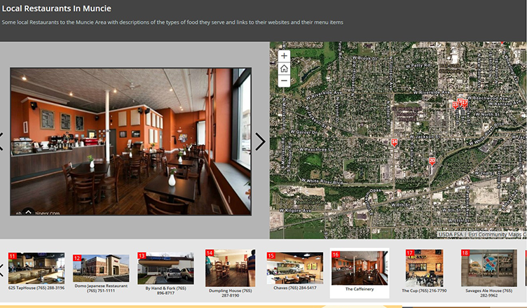
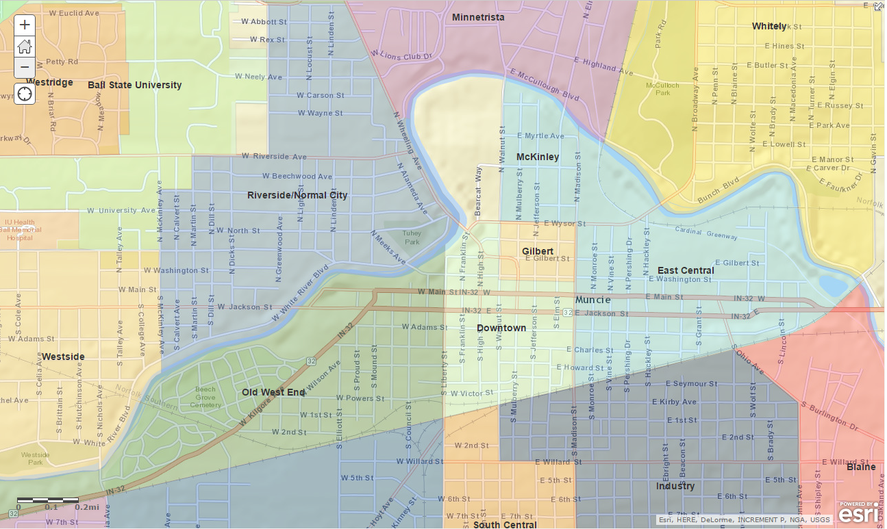
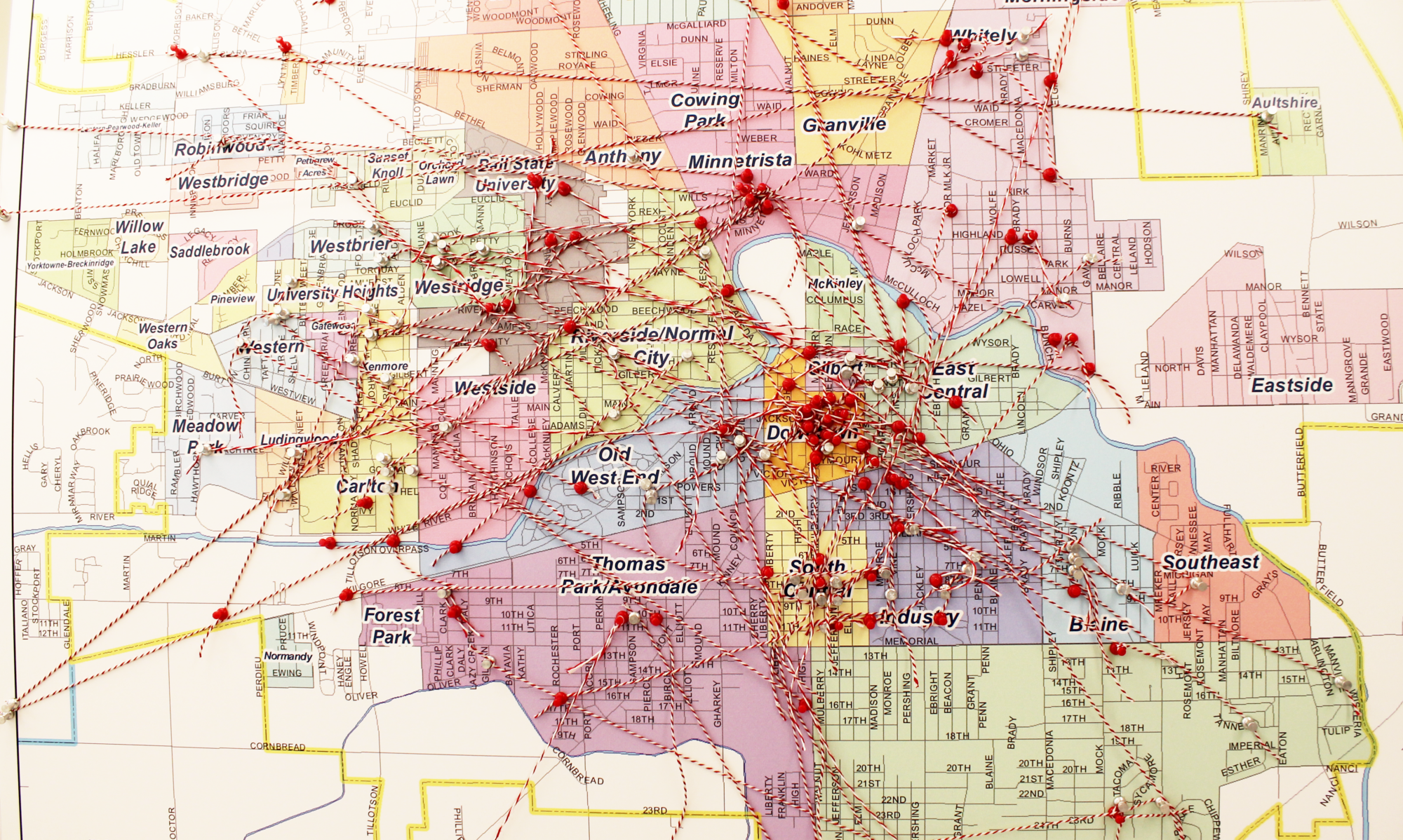
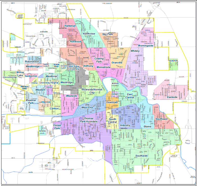
Muncie is unique in that if you are inside the city limits, you are more than likely in a neighborhood. Unlike other cities, which have one or more historic neighborhoods surrounding a downtown, Muncie is a city of neighborhoods. It has been said that its current map was devised through public comment and at the hand of the City of Muncie’s Community Development Department in the 1960’s. That the small size of the westside neighborhoods are due to their historic plats and covenants, many of which still held some power, and the vastness of Southside was due to a brother and sister that lived on opposite ends that expressed a desire to live in the same neighborhood.

Click here to view the map of Muncie’s current neighborhoods.

Makerspaces

In the Spring 2020 Semester, the Virginia Ball Center for Creative Inquiry hosted an amazing program allowing students with the BSU English Department in partnership with the Muncie Arts and Culture Council to explore the “makers” movement becoming increasingly popular in our cities. The investigation covered some of the cool makerspaces here in Muncie and culminated in a large enough collection of stories and data for 2 print books – a compilation of oral histories and a collection of photo essays featuring stories of Muncie makers. Learn more at the website for the project on the Virginia B. Ball Center for Creative Inquiry’s site, and check out these other awesome resources!

Project Website | Seminar Facebook Page | Interactive Map of Muncie & Surrounding Area Makerspaces


Faculty Mentor: Laura Romano
Department: English
Community Partner: Muncie Arts and Culture Council
Student Team: Stressca Nathaniel, Tamera Sims, Jack Satter, Elizabeth Baum, Mason Killebrew, Jessica Snow, Andrew (Drew) Catalano, Halie Wills, Sarah Morrow, Laura Romano, Darrin Sims, Elizabeth Riester, Hannah (Cali) Fehr

Tourist Maps for Muncie and Delaware County

Students in Geography 341 (Cartography and Visualization of Spatial Data) partnered with the Muncie Visitors Bureau to produce visual materials that promote Muncie attractions to area visitors. Students collected and organized data during the semester and explored possible map designs for both print brochures and interactive online applications. Guides on restaurants and breweries, Muncie pop culture, the Garfield trail, and the Bob Ross experience are just some of the pieces completed by the students.


Faculty Mentor: Jörn Seemann
Department: Geography
Community Partner: Muncie Visitors Bureau
Student Team:  Alyssa Bilbrey, Jarrett Braden, William Cape, Dan Council, Becca Garrett, Nathan Gidley, Elante Ingram, Jamie Johnson, Benjamin Lutz, Riley Mccreary, Ben Meyer, Jordan Verdeyen, Clay Zeigler

Geospatial Design Laboratory

Geospatial data – data that is associated with a particular location – is an increasingly valuable asset for managing, analyzing, and displaying information related to geographic areas. Students partnered with organizations such as the Delaware County Food Council and Cardinal Weather Service to collaborate on intensive, hands-on projects that resulted in maps, charts, data, and other tools that would benefit the partners. Students identified the project objectives and acquired and prepared geospatial data for analysis. They communicated with community partners to assess progress on the project and produced high-quality products. During the project, students partnered with the Delaware County Food Council, used maps and graphics to tell an engaging story about food access, and designed a digital survey that collected local input as to where residents shop for food and how they perceive food access in the county.


Faculty Mentor: Jörn Seemann
Department: Geography
Community Partner: Muncie Visitors Bureau
Student Team: Jarrett Braden, Bailey Brooks, William Cape, Nathan Gagnon, Becca Garrett, Jacob Haas, Zach Hagemeier, Elante Ingram, Jamie Johnson, Aaron Jones, Connor Kurtz, Joseph Lopilato, Benjamin Lutz, Riley McCreary, Ben Meyer, Patrick Ollier, Rachel Pereira, Nathan Santichen, Kelby Smith, Letia Snorden, Jonathan Strang, Jordan Verdeyen, Maggie Warren, Andy Wilson, Erick Wilson, Jordan Wolfe, Clay Zeigler

Muncie GIS Resources Map for Neighborhoods

Kyle Johnson, Director of the Delaware County GIS Department presented at the March 2015 Neighborhood President’s Council meeting. In response to audience interest, Kyle created an online map of Muncie that includes the ability to view the following data:

  • Properties in Multiple Tax Sales (unsold tax delinquent properties)
  • Muncie Street and Park Trees
  • Crime Density (all Crimes 2009-2014)
  • Hardest Hit Funds Demolitions Properties (round 1 & 2)
  • Parcels (links to Beacon for info)
  • Fire Hydrants
  • Bicycle Friendly Roads
  • Bike Lanes
  • Art & Culture Trail
  • Greenways & Trails
  • Muncie Historic Districts
  • Parcels with Homestead Exemptions (owner occupied)
  • Neighborhood Boundaries
  • UBHA properties (all properties brought before the Unsafe Building hearing Authority since 2012)
  • Muncie Sidewalks
  • Zoning

In order to view the above listed layers, please click on “Content” in the left hand side of the browser. You will be able to turn layers on and off by checking the individual boxes.